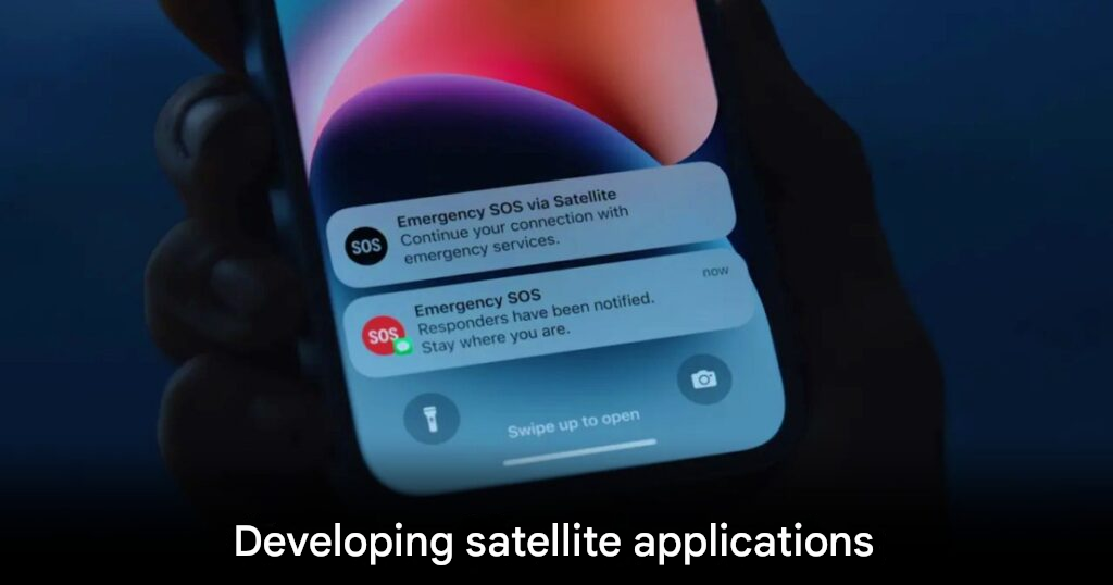
Apple already allows iPhone users to contact emergency services and roadside assistance via satellite when there is no mobile or WiFi signal. According to recent reporting, the company is now working on a broader set of satellite-based features designed to expand device usability in remote or disconnected areas. These developments include a planned API that would allow app developers to tap directly into satellite connections, a version of Apple Maps capable of full navigation without cell or WiFi, support for sending photos over satellite, and more natural-usage scenarios where the phone does not need to be pointed at the sky to connect.

These planned upgrades could transform how the iPhone works outside traditional networks. One key area is enabling third-party apps to use satellite links for communications or data—opening opportunities for new services in remote regions. Apple’s satellite partner Globalstar reportedly needs infrastructure upgrades and Apple is reportedly helping finance those improvements. While some basic features may remain free, future premium services might require a carrier subscription.
For users in Southeast Asia and global markets, these changes hint at a future when smartphones remain useful even without terrestrial networks. As Apple expands satellite functionality, devices may become ideal tools in remote, rural or disaster-hit zones. The move also positions Apple ahead of regulatory and competitive shifts in connectivity. While pricing, rollout timing and region availability are still unclear, the ambition is significant.
origin: Techcrunch